Journey Around the World with the Universal Atlas of Fernão Vaz Dourado
By João Carlos Garcia
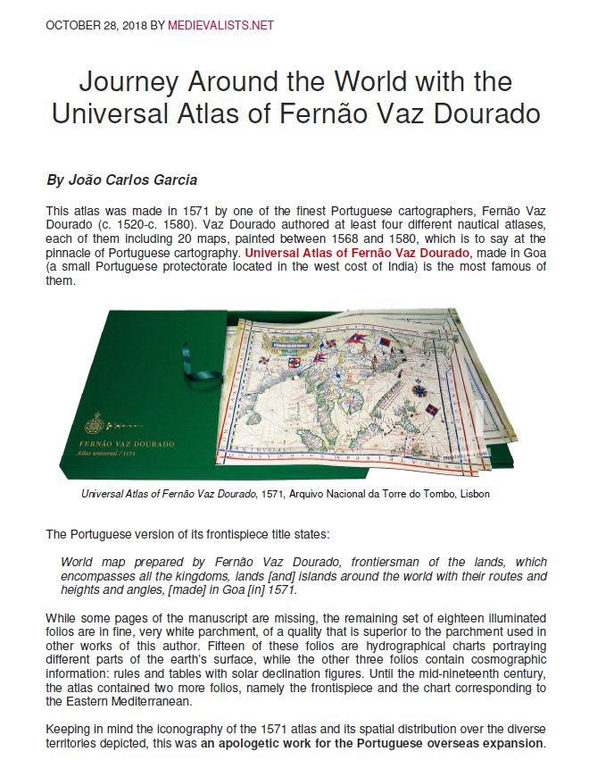
This atlas was made in 1571 by one of the finest Portuguese cartographers, Fernão Vaz Dourado (c. 1520-c. 1580). Vaz Dourado authored at least four different nautical atlases, each of them including 20 maps, painted between 1568 and 1580, which is to say at the pinnacle of Portuguese cartography. Universal Atlas of Fernão Vaz Dourado, made in Goa (a small Portuguese protectorate located in the west cost of India) is the most famous of them.
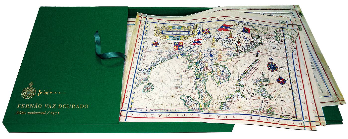
Universal Atlas of Fernão Vaz Dourado, 1571, Arquivo Nacional da Torre do Tombo, Lisbon
The Portuguese version of its frontispiece title states:
World map prepared by Fernão Vaz Dourado, frontiersman of the lands, which encompasses all the kingdoms, lands [and] islands around the world with their routes and heights and angles, [made] in Goa [in] 1571.
While some pages of the manuscript are missing, the remaining set of eighteen illuminated folios are in fine, very white parchment, of a quality that is superior to the parchment used in other works of this author. Fifteen of these folios are hydrographical charts portraying different parts of the earth’s surface, while the other three folios contain cosmographic information: rules and tables with solar declination figures. Until the mid-nineteenth century, the atlas contained two more folios, namely the frontispiece and the chart corresponding to the Eastern Mediterranean.
Keeping in mind the iconography of the 1571 atlas and its spatial distribution over the diverse territories depicted, this was an apologetic work for the Portuguese overseas expansion. It even depicts the world as defined by the Treaty of Tordesillas: with the exception of Europe, which contains flags and coats of arms representing diverse nations, the possession of cities, states and territories is only marked by the heraldic symbols of Portugal and Spain. These two great rival powers were only contrasted with Islamic and the Chinese empires.
The 15 charts that constitute the atlas are presented to the beholder in a geographic sequence, as though it were a journey circumnavigating the globe. The earth’s surface is observed by means of broad and successive windows. From the Strait of Magellan the charts follow the eastern shores of the Americas up to the far north of Canada. This is followed by the western coast of Europe, from Scandinavia to the Iberian Peninsula, the Western Mediterranean and Eastern Mediterranean (in the missing folio), West Africa, Southern Africa, Madagascar and East Africa, the western and eastern Indian Ocean, the eastern shores of Asia and the archipelagos of Oceania, the Pacific and, finally, the western shores of the Americas.
Coast of Brazil
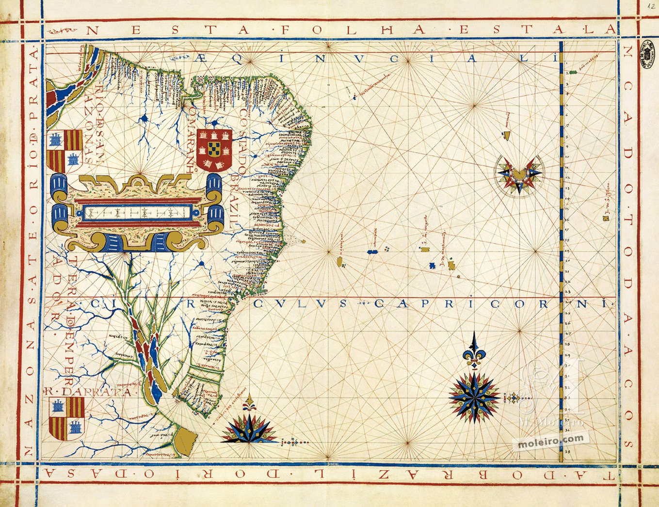
Universal Atlas of Fernão Vaz Dourado, 1571, Arquivo Nacional da Torre do Tombo, Lisbon
Coast of Brazil
Coast of Brazil
The complementary nature of maritime and continental spaces and the decisive importance of the former are quite evident in this folio. The locations of islands and archipelagos are related by means of maritime routes, as is the case with the alignment of islands and islets between 18ºS and 21ºS, in an East-West direction.
Madagascar and the islands to the south of the equinoctial line
Universal Atlas of Fernão Vaz Dourado, 1571, Arquivo Nacional da Torre do Tombo, Lisbon
Madagascar and the islands to the south of the equinoctial line
Along with the next folio, this map depicts the western Indian Ocean, [...] and is particularly dedicated to maritime routes between East Africa and India, using diverse archipelagos and islands as points of reference and stopovers on these routes.
Near the scale of latitudes, at the base of the map, over the corner, one can observe a discreet but important caption: “Island found by St. Paul 38º”, referring to the discovery of the island by the Portuguese when a carrack named São Paulo was shipwrecked.
China, Japan and part of Southeast Asia
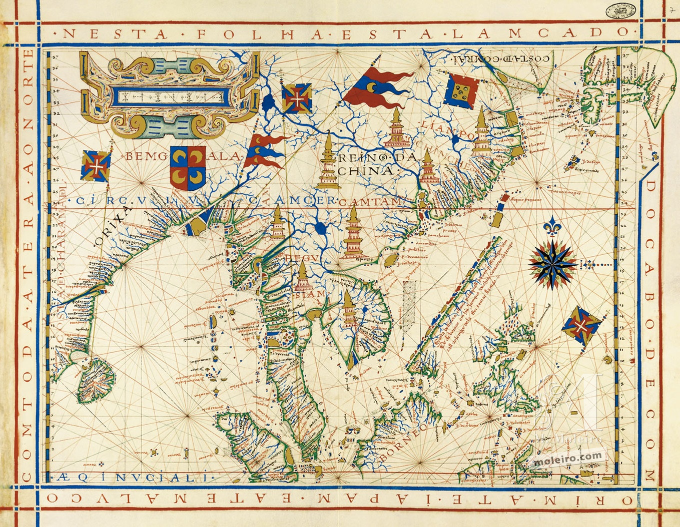
Universal Atlas of Fernão Vaz Dourado, 1571, Arquivo Nacional da Torre do Tombo, Lisbon
China, Japan and part of Southeast Asia
The map meticulously portrays the coasts (Malaysia, Indo-China, Borneo, China), the archipelagos and the numerous islands of the Eastern Indian Ocean and the South China and East China seas, as well as the entrance to the Pacific Ocean.
The location of points (ports and islands) which, when viewed together, show the configuration of the coasts was based on nautical itineraries and hence often have a rectilinear and sequential aspect. This also explains the lack of information about coasts that were peripheral to these itineraries, as is the case with the coasts of the Gulf of Thailand and the Gulf of Tonkin, and the better information about coasts that were commercially more attractive, such as the region between Canton and Shanghai.
A record of a voyage by a European abroad a Chinese vessel through the South China Sea is clearly expressed in the following caption: “Coast of Luzon and Laos along with travelled P[edro] Fidalgo from Borneo in a Chinese junk, who sailed along it due to a storm arriving at Lamau.” This compact and rectilinear “coast” on the chart is clearly the sequence of the westernmost islands of the Philippine archipelago.
Four Portuguese flags are implanted in specific places and territories: Ceylon, Malacca, Japan and the Moluccas. In terms of Muslim power there is only a large shield with crescents dominating the Bay of Bengal; all of East Asia (China, Thailand, Indo-China) is illustrated, apart from the names of the main kingdoms, with eight large pagodas, which indicate another religion not yet mentioned in the atlas, i.e. Buddhism.
This is probably the most well-known folio in Vaz Dourado’s atlases, not just because it includes many of the geographic novelties of the Far East for Europeans but also due to its iconography and rich colours.
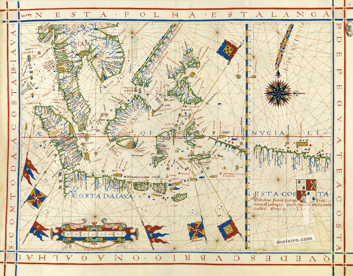
Southeast Asia and the coast discovered by Ferdinand Magellan up to the coast of Java
Universal Atlas of Fernão Vaz Dourado, 1571, Arquivo Nacional da Torre do Tombo, Lisbon
Southeast Asia and the coast discovered by Ferdinand Magellan up to the coast of Java
The four flags that indicate the Portuguese presence and possession of various places and territories have been scattered over Malacca, the Moluccas and the islands of the Banda Sea (Banda and Ambon). [...] The following inscription surrounds the shield:
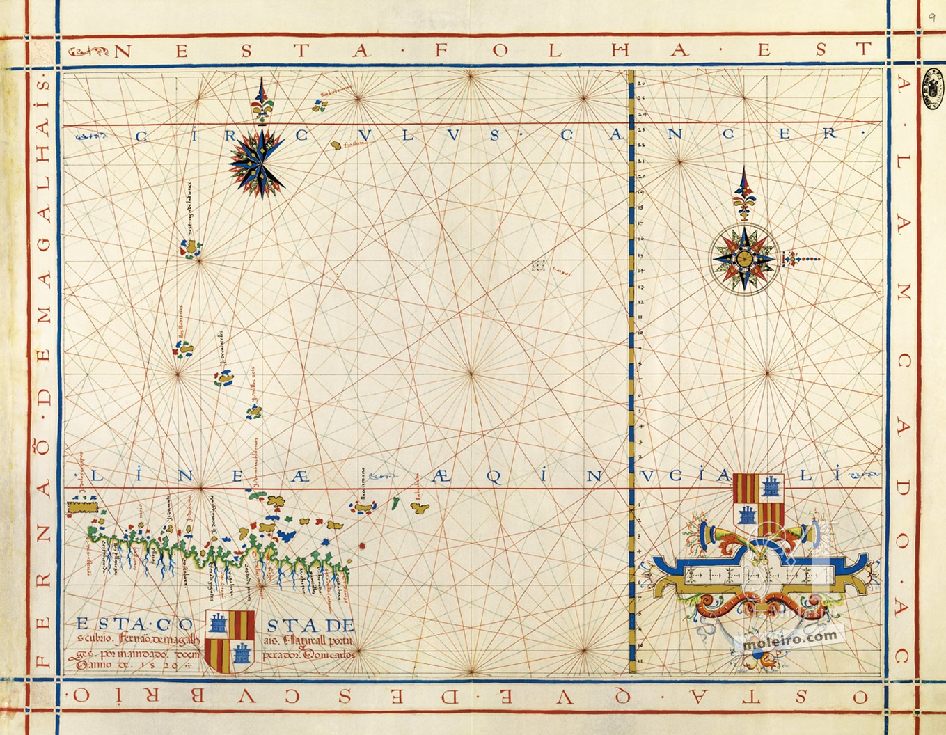
“This coast was discovered by Ferdinand Magellan, a native of Portugal, on the orders of Emperor Charles in the year 1520.”
However, the east-west coast depicted, continued on the following folio, illustrates one or various nautical itineraries, parallel to the Equator, 4º south of it. This is clearly the northern coast of New Guinea, which Magellan did not visit and which was first explored by Dom Jorge de Meneses, on the Portuguese side, and by Álvaro de Saavedra, on the Spanish side, in 1527, and later, in greater detail, by Villalobos and Iñigo de Retes, who conferred the island’s name in 1545.
Universal Atlas of Fernão Vaz Dourado, 1571, Arquivo Nacional da Torre do Tombo, Lisbon
The coast discovered by Ferdinand Magellan (Indonesia)
This was an excerpt from the commentary volume of the Universal Atlas of Fernão Vaz Dourado by João Carlos Garcia (Faculty of Arts and Humanities of the University of Porto)
