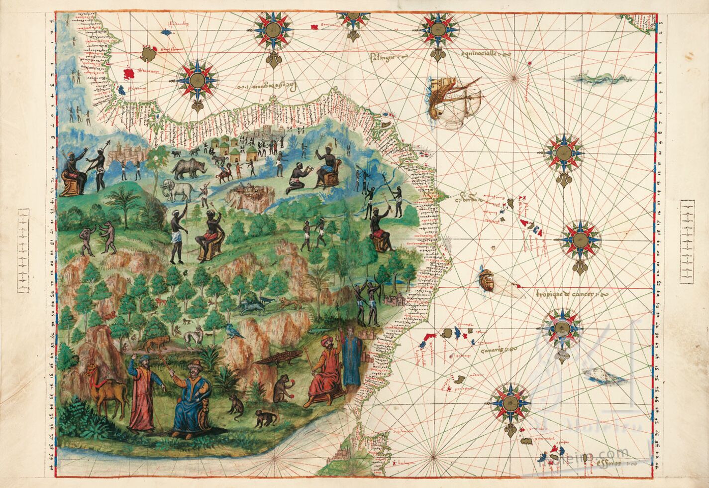
Northwest Africa
The following map depicts the western coast of Africa and a part of the Iberian Peninsula, the adjacent archipelagos and a patch of Northeast Brazil. In cartographical terms it is perhaps the most perfect of all the maps contained in this atlas, which is not surprising since it portrays regions that had been meticulously explored by the Portuguese from 1434 onwards.
The iconographic programme clearly distinguishes Black Africa, with Negroid and semi-naked inhabitants, from the Maghreb, populated with white figures dressed in Muslim garments. An indigenous potentate and a conventional sketch of a walled city have been drawn at the deepest area of the Gulf of Guinea. This was probably an allusion to the kingdom of Benin, with which the Portuguese had maintained diplomatic relations since the 1485 embassy headed by João Afonso de Aveiro. The iconography is quite realistic to the west, representing African fauna such as an elephant and a rhinoceros, various hyenas and an indigenous village, with round thatched huts with their characteristic conical stepped roofs.
The geographic nomenclature of the African coast almost entirely comprises nautical toponyms and names linked to discoveries, based on the shape of the coast or on fortuitous episodes that occurred when they were first explored. Only three or four toponyms have indigenous origins, such as Benin. Some toponyms have descriptive origins, such as Cape Verde. Other names evoke more or less fortuitous episodes, such as memorable catches of prawns (gambas in Portuguese) landed by the explorers in the river that began to be called Gambia. Other toponyms allude to an age-old trade in commodities, as is the case with the fortress of Mina (mina means ‘mine’ in Portuguese and reflected the gold found in the region). Other geographical features, such as the Rio S. Domingos, St. Paul’s Cape, etc., were named after saints, probably the saints whose feast day fell on the day the sites were discovered.
It is interesting to note that most of these toponyms continue to be used even today. This persistence is apparently greater in this region than in any other area, which could be due to two factors: the antiquity of their discovery, providing sufficient time for the names attributed by early explorers to become firmly rooted in cartography; and the inhospitable nature of the region, notorious for its fevers, which did not favour a permanent European presence.
Luís Filipe F. R. Thomaz
Director of the Institute for Oriental Studies of the Portuguese Catholic University
(Exert from the commentary volume Atlas Vallard)
